News · 12 min
GTA 6 Map Size: How Big Leonida Is and Where the Launch Trailer Sits on the Map
RENZI’s October 24, 2026 video walks through version 17 of the fan-made map of Leonida and pins each shot of the launch trailer onto it. This article adds what Rockstar has actually said about the map’s size, sorts the first-party figures from the second-hand ones, and labels every position on the map as the community’s reading, not Rockstar’s.
 Made withRENZIYouTube creator visit the channel Add GTA6 Heists as a preferred source on Google
GTA 6’s map is about twice the size of GTA 5’s, according to Rockstar’s Aaron Garbut as relayed by Game Informer, and Rockstar has not published a figure in miles or kilometers. The other number you will see everywhere, three times the playable area of Red Dead Redemption 2, comes second-hand from Rob Nelson via a post shown in another creator’s video, so treat it as reported rather than confirmed. Everything below the size question is a fan map, not Rockstar’s.
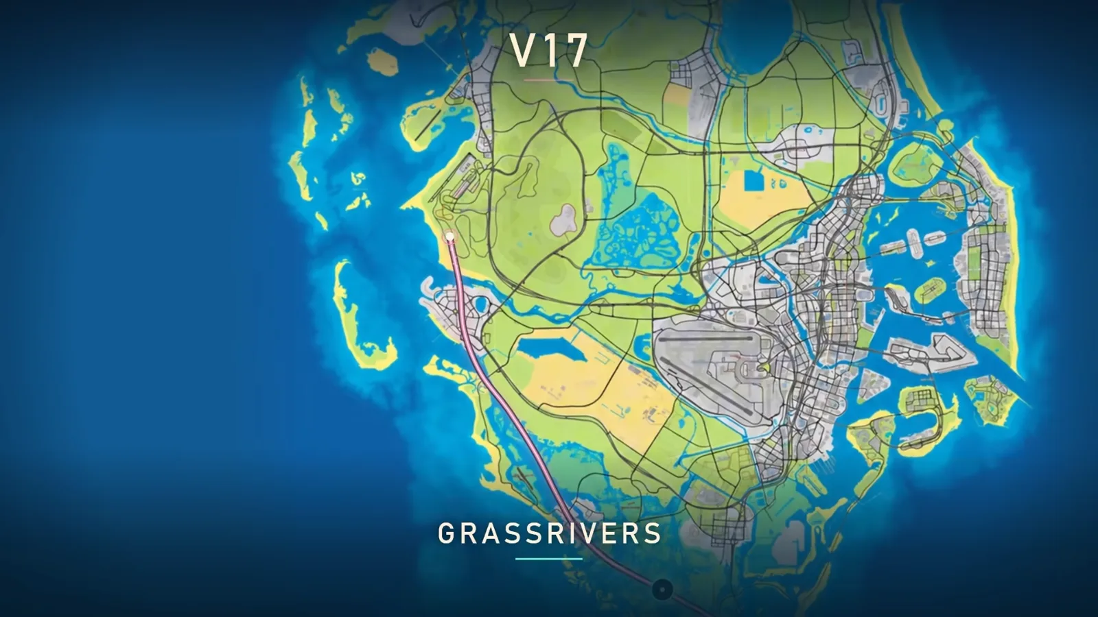
RENZI’s October 24, 2026 video walks through version 17 of the community map of Leonida, built by Yanis and a crowd of contributors, and pins the shots of Rockstar’s launch trailer onto it one by one. His video shows where on that map each scene is said to sit. The size and interior figures come from Rockstar’s press material. The game is not out until November 19, 2026, so every position below is a reading, labeled as one.
How big is the GTA 6 map?
Two Rockstar-attributed statements exist, and they agree. Game Informer’s issue 382 cover story (September 29, 2026), read on screen by SubscribeForTacos, says Garbut called Leonida the biggest map Rockstar has ever created “by some degree,” twice as large as GTA 5 and more dense, detailed and interactive. Edge’s feature, read aloud by TGG on October 29, 2026, repeats “roughly twice the size of GTA 5’s” and adds that Rockstar puts the total land mass, Vice City and surrounding areas included, at nearly the playable maps of GTA 4, GTA 5 and Red Dead Redemption 2 combined.
| Claim | Who says it | How solid it is |
|---|---|---|
| About twice the size of GTA 5, the biggest map Rockstar has made | Aaron Garbut, via Game Informer, issue 382 (September 29, 2026) | Rockstar-attributed, paraphrased by the outlet |
| Land mass nearly the playable maps of GTA 4, GTA 5 and RDR2 combined | Rockstar statement, via Edge, read by TGG (October 29, 2026) | Rockstar-attributed, not a named quote |
| Three times the playable area of Red Dead Redemption 2 | Rob Nelson, via an X post shown in Hazard’s video (October 10, 2026) | Second-hand, original wording not read in full |
| Vice City alone about twice Los Santos | Same post | Second-hand |
| Built-up area outside Vice City about 11 times the built-up area outside Los Santos | Same post | Second-hand, and the post words it slightly differently from Hazard’s narration |
| Square miles or kilometers | Nobody at Rockstar | Not published |
Is the GTA 6 map bigger than GTA 5 and Red Dead Redemption 2?
Yes for GTA 5, by Rockstar’s own account, and probably for Red Dead Redemption 2 if the relayed figure holds. Redo the arithmetic: if Leonida is twice GTA 5 and three times RDR2, then RDR2 is two thirds of GTA 5. Hazard’s overlay agrees: RDR2 looks a bit smaller than GTA 5. Land mass and playable area are different measures, so Edge’s “combined” comparison cannot become one multiplier.
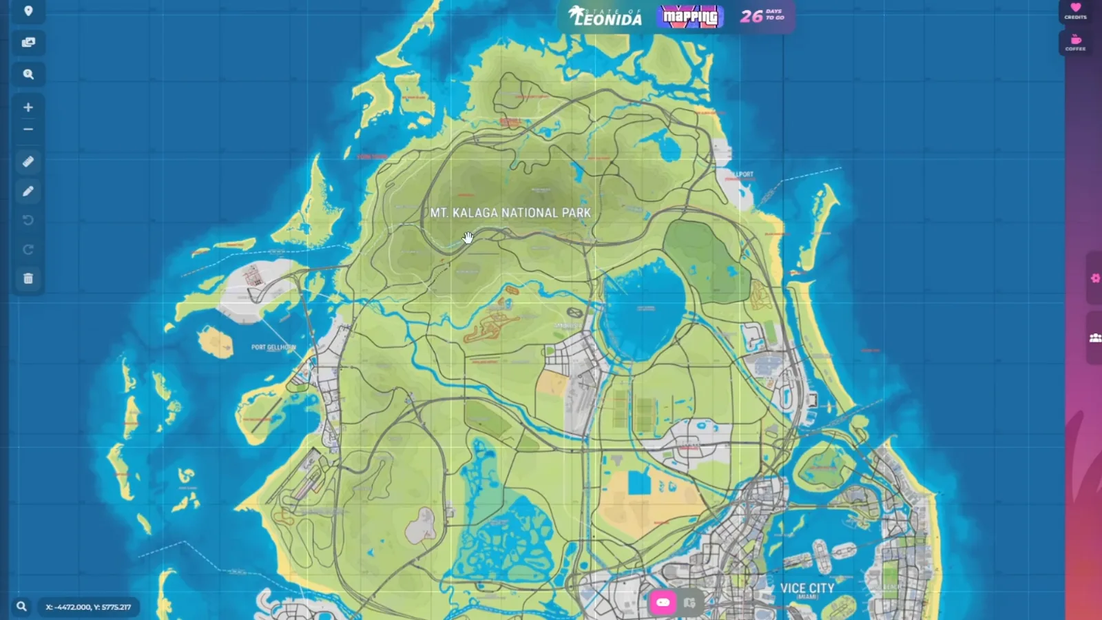
Size is not the interesting part, and Garbut says as much: he calls the map more dense, detailed and interactive. Hazard’s version is that Rockstar is taking Red Dead 2’s density and scaling it up. That is his reading. What is Rockstar’s is the Edge line that GTA 6 has “an order of magnitude more interiors” than its predecessors, which is where the community map and RENZI’s video come in. For the six regions Rockstar itself names, the site already has a region-by-region guide in every GTA 6 location explained and the embedded interactive map.
Is the GTA 6 map on the internet real?
No. It is a fan reconstruction, and RENZI himself calls version 17 “the closest we have ever been to the real GTA 6 map,” which is a way of saying it is not the real one. Hazard, walking through the previous version, says the project folded in the roughly 12 clips leaked in August and the Extended Look. The leaks are the weak point: nobody outside Rockstar can say how much of the leaked build survives into the shipped game.
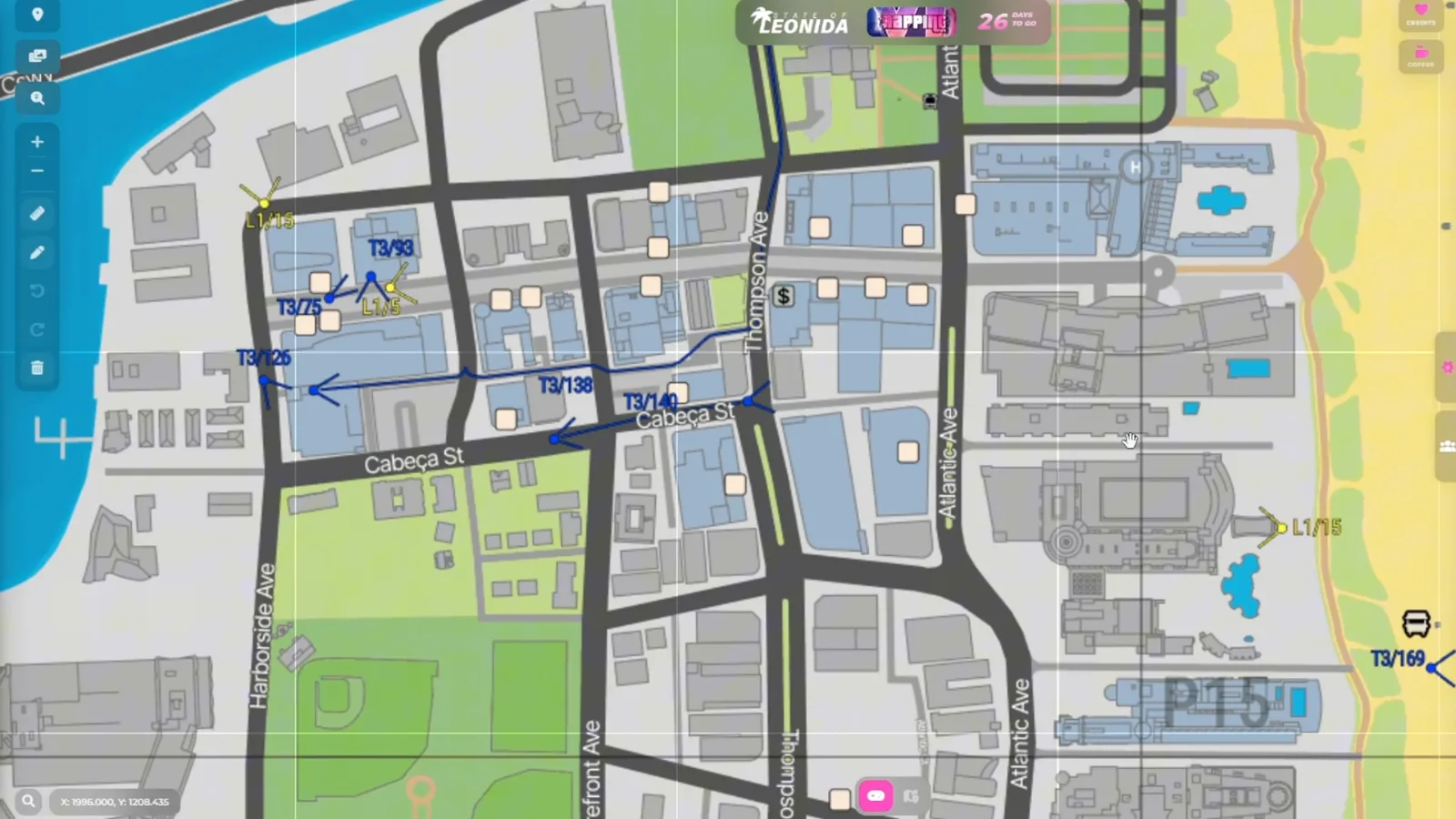
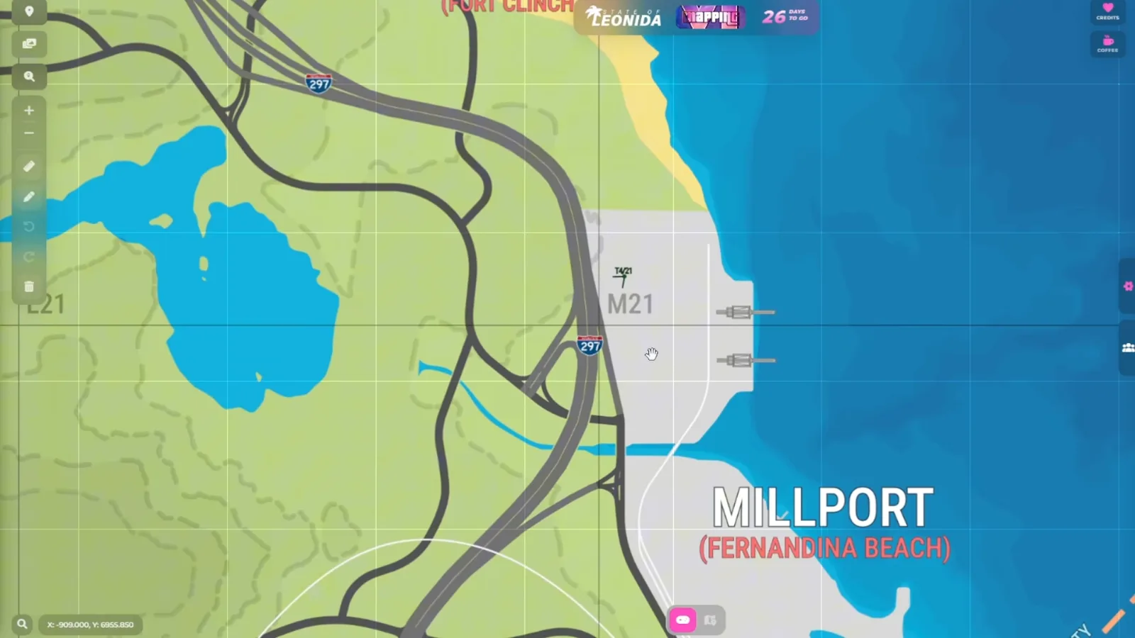
In RENZI’s frames, a name in brackets such as “Vice Beach (Miami Beach)” pairs a map label with the real place it is modeled on, and red lettering, as on Millport, appears to follow the speculative styling. The color key was not legible on screen. Rockstar’s own copy names Ocean Beach, not Vice Beach: both names sit on this map, and only one is Rockstar’s.
How many buildings can you enter in GTA 6?
Rockstar says far more than before, and has not said how many. Edge quotes the studio as saying the game has “an order of magnitude more interiors” than its predecessors, and Game Informer quotes Garbut saying the team “obsessed about every part – the rooftops, the alleys, the internals” until it hit “a critical mass with the numbers of our interiors.” No count is given.
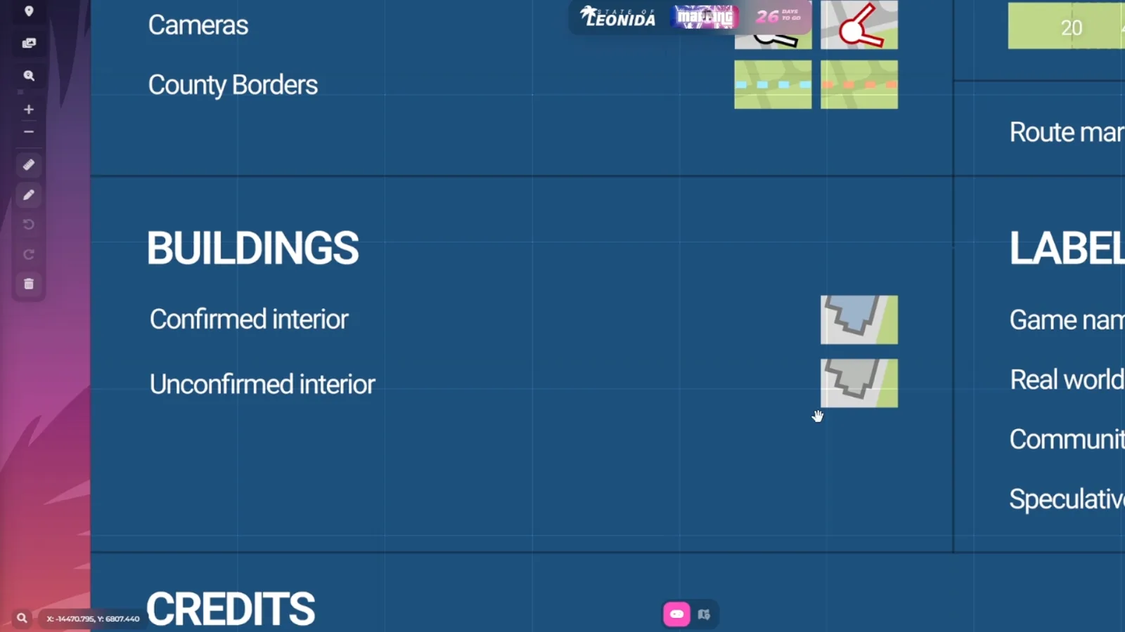
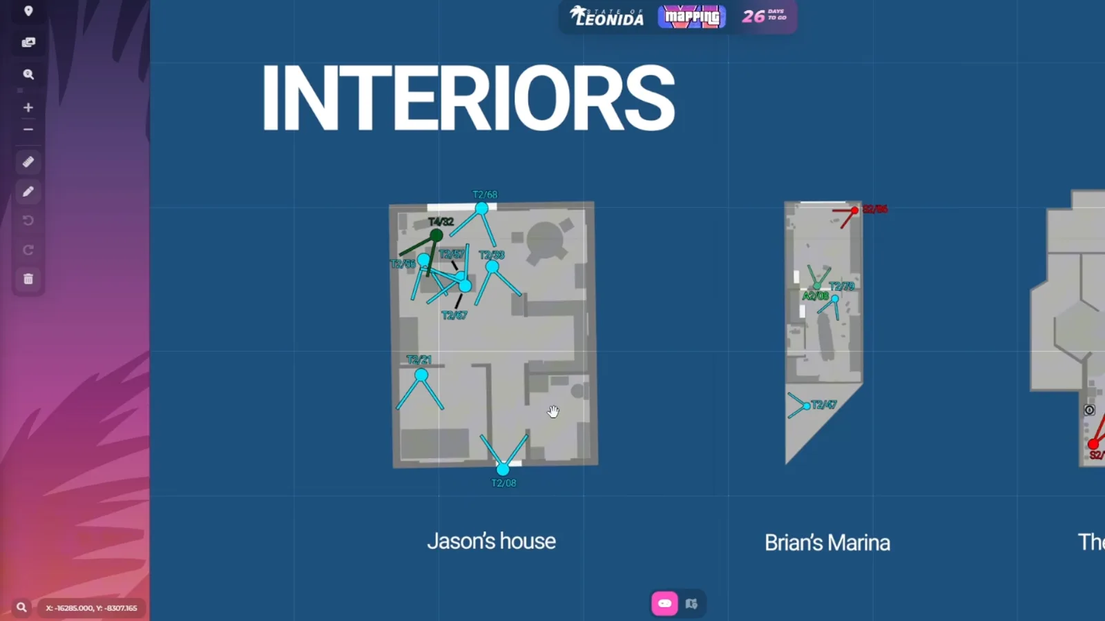
RENZI’s count is the fan map’s. He says the blue buildings are interiors we will “definitely” be able to enter, the gray ones may or may not have one, and that hundreds and hundreds of interiors across the map is already much more than GTA 5 or Red Dead 2 had. The direction agrees with Rockstar. The number and the word “definitely” are his: we do not know what the mapping community counts as confirmation (the video does not say), and Eurogamer’s own list of Leonida points of interest carries the caveat that not all of them are enterable.
The map even carries floor plans. Near the end of the video RENZI scrolls a panel of interiors the community has reconstructed from trailers, among them Jason’s house and Brian’s Marina. Treat those plans as a mapper’s sketch of what a few seconds of footage allow, not a layout from the game.
Where is the GTA 6 launch trailer set on the map?
Almost entirely on the east and south of the island, in Vice City and the Leonida Keys, with one stop in the north. RENZI goes through Rockstar’s 90-second launch trailer, published October 15, 2026, in order and says where the community pinned each shot. What is on screen in the trailer is official. Where it sits on the map is the community’s, and RENZI relays it.
| RENZI’s timestamp | Launch trailer shot | Where he says it sits on the map |
|---|---|---|
| 2:40 | Car off a bridge, “Welcome to the Keys” sign, signs to The Rusty Anchor and a 24/7 store | North end of Key Lento, Leonida Keys |
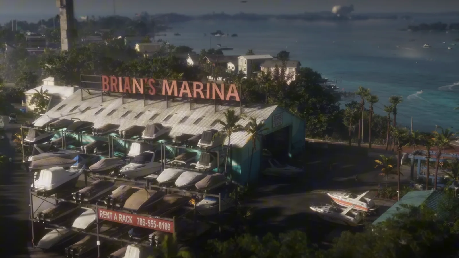
| 3:11 | Brian’s Marina | North-west end of Key Lento, near the safe house |
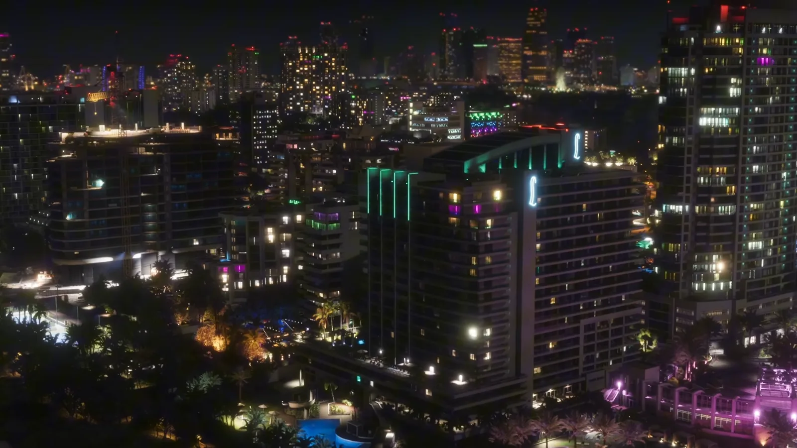
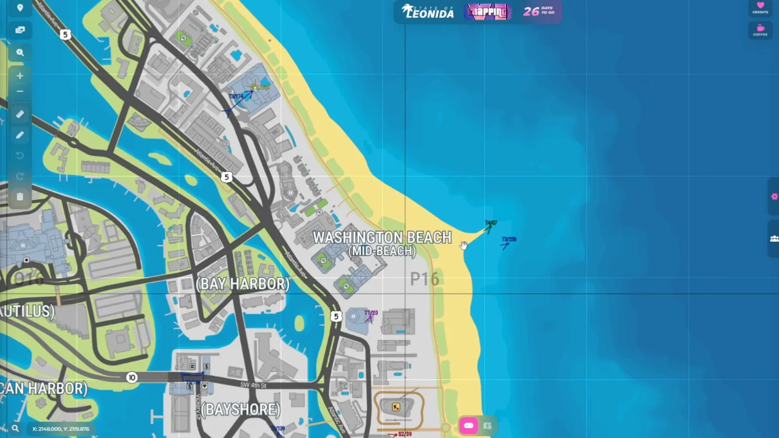
| 4:19 | Vice City at night | Washington Beach, northern Vice Beach |
| 4:40 | Iguana by a roundabout sign | The Tequesta area, at a roundabout |
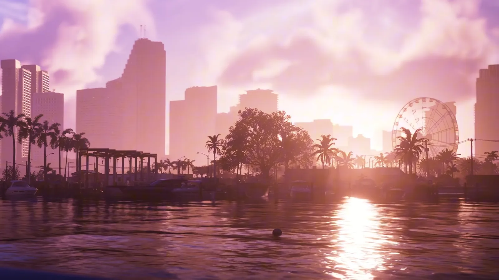
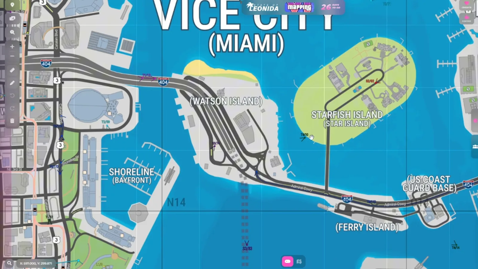
| 5:00 | Ferris wheel over the water | Near Starfish Island, looking over Watson Island |
| 5:32 | Jason and Lucia in a car | A bridge near the port of Vice City |
| 6:06 | Lucia jumping onto a plane | Vice City International Airport |
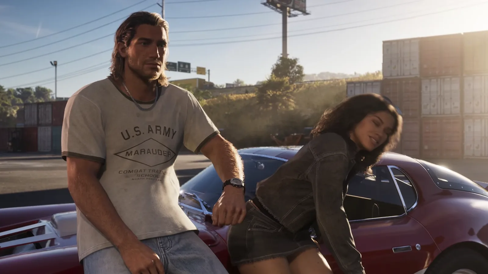
| 6:25 | Jason and Lucia by containers | Millport, near Mount Kalaga |
| 6:50 | Green cars speeding | Vice Beach, in front of the Ocean View Hotel |
| 7:40 | Jason on a helipad as a helicopter explodes | A rooftop near Little Cuba, downtown |
| 8:08 | Plane stunt | Vice Beach |
| 9:15, 9:36, 10:36 | Helicopter grenade launcher, Lucia on a balcony, wrecking-ball helicopter | Tequesta Retreat, the map’s Brickell Key |
| 11:07 | Last shot, with Mount Kalaga in the distance | Vice Beach, looking toward the mountain |
Where are the Keys shots, the sign and Brian’s Marina?
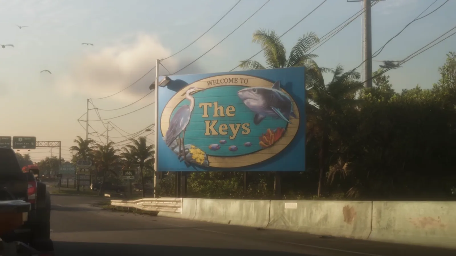
RENZI puts the trailer’s opening in the Keys at the top of Key Lento. A car comes off a bridge past a “Welcome to The Keys” sign, and a second sign points to The Rusty Anchor bar. In the trailer those shots run from about 0:02 to 0:13.
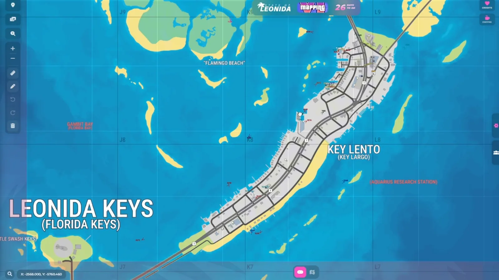
Brian’s Marina is the best-documented place in the trailer: the sign is legible, and the frame shows a rack of boats under a “Rent a Rack” banner. It already has an official footing, since Rockstar’s own panel names Brian Heder’s boat yard in the Keys. The community map puts the marina on the north-west tip of Key Lento, near the safe house that Jason and Lucia share and near the bar. RENZI’s read is that the key itself is small and will be packed with things to do, which is a hope, not a fact. The same stretch of map is where he pins the safe house shot with Cal Hampton and the snake from the second trailer.
Where are the Vice City night and sunset shots on the map?
On the beachfront and the islands in front of downtown. RENZI’s night skyline sits on Washington Beach, the northern stretch of what the map labels Vice Beach, looking over the small area in front of it. Washington Beach and Vice Beach are labels on the fan map; Rockstar’s own Vice City copy says Ocean Beach.
The ferris wheel shot is the easiest to place. The wheel and the nearby Sahara Arena are landmarks the map shows, and RENZI pins the camera over the water near Starfish Island, looking across Watson Island toward them. He says the same spot is where we see “lots of those boats and yachts.” Two other trailer shots land in the same part of the harbor: Jason and Lucia in a car on a bridge near the port, with buildings of Tequesta Retreat behind them, and a downtown race near the wheel and the Shoreline district.
Where is the containers shot, and is there a port in the north?
This is the one shot RENZI moves off the coast. Jason and Lucia lean on a red sports car with shipping containers, a highway, a billboard and a truck behind them. In Rockstar’s trailer it runs from about 0:40. He places it in the north, near Mount Kalaga and a small port with cranes and containers that the map calls Millport. The name is in red, the speculative styling, with the real place it is modeled on in brackets. He reads the location from the containers, the cranes on the map and the highway behind the pair, which is thin evidence.
Where is the helipad shot with the exploding helicopter?
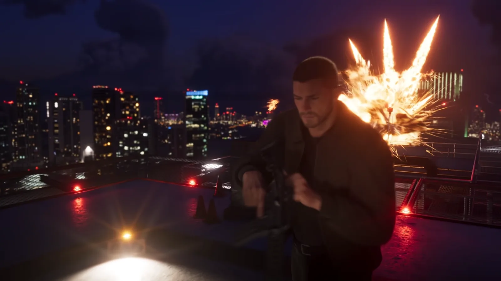
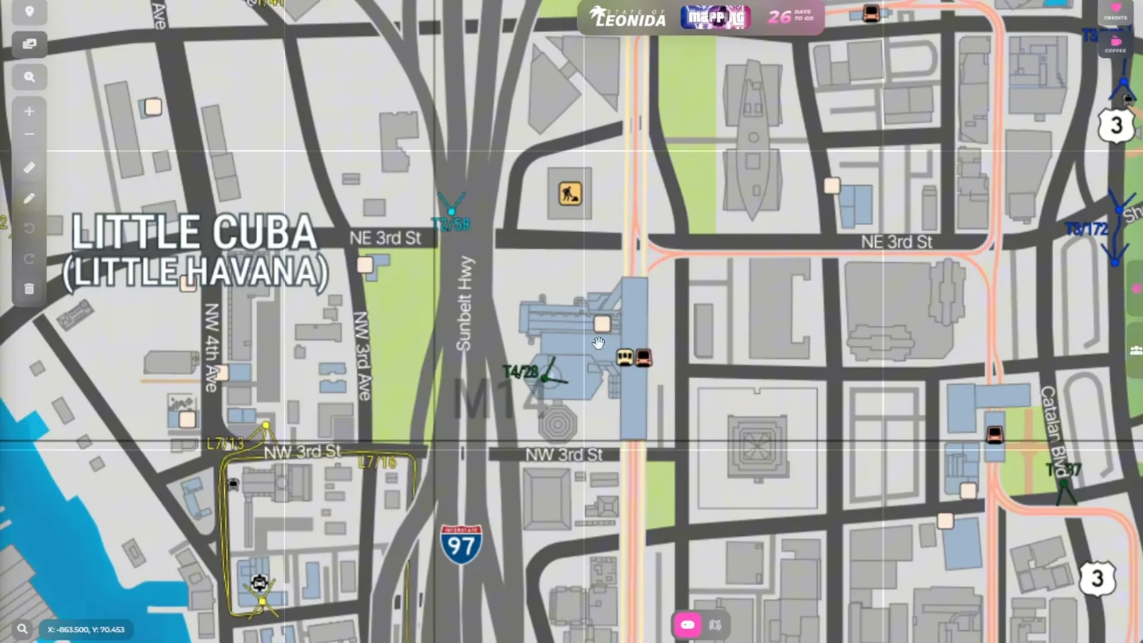
RENZI says on top of a building near Little Cuba, in downtown Vice City, where the map shows a helipad icon and a train line running through the building. In the trailer it runs near the 0:52 mark: Jason with a rifle on a night rooftop, a fireball and a helicopter silhouette behind him. It is a guess you can check on the ground once the game is out.
What else is on the map besides Vice City?
Quite a lot. RENZI’s tour is Vice City-first, but his frames show Hamlet, labeled “Homestead” in brackets, a suburb southwest of the city, Watson Bay as “Cedar Key,” the Grassrivers marsh, Port Gellhorn on the west coast and Ambrosia inland. The six regions Rockstar names are on the GTA 6 map; the community adds the towns between them.
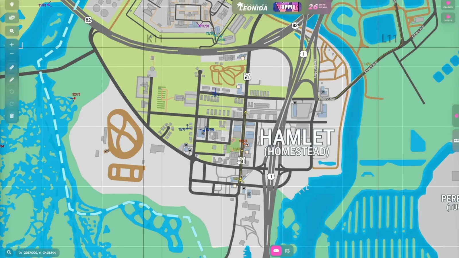
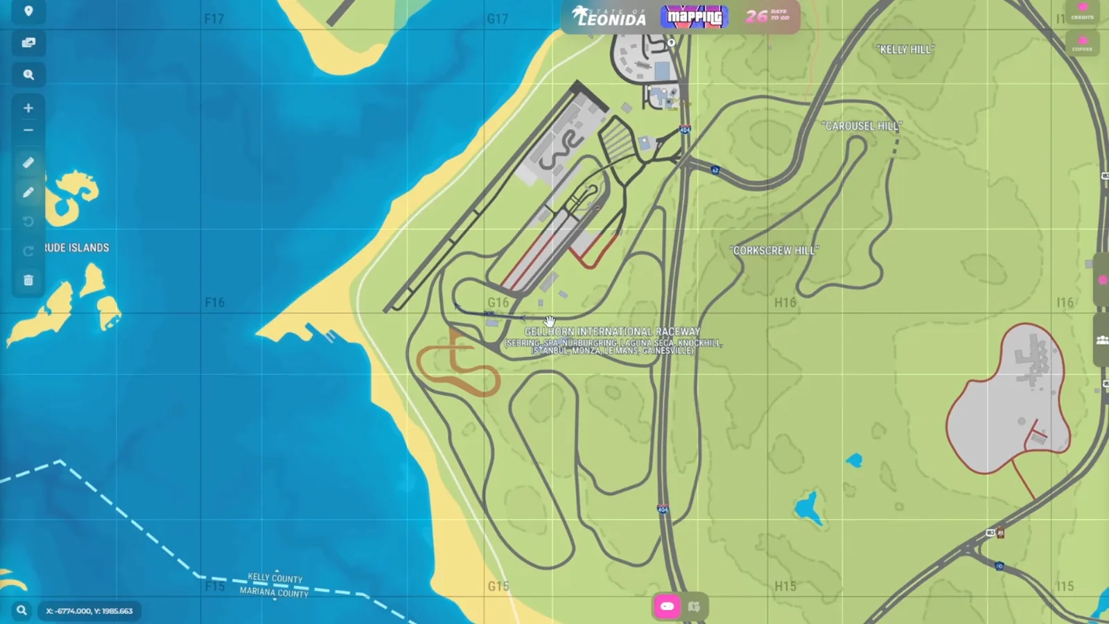
Two Extended Look locations get their own mention: the Thrillbilly Mud Club beside Ambrosia, which the frame labels with a bracketed “Redneck Yacht Club,” and Gellhorn International Raceway on the west coast, labeled with a long list of the real circuits it draws on. Another creator’s reading, GameSift’s, puts the mud club in Mount Kalaga instead, so where it sits is contested.
Will the final GTA 6 map match the community map?
Only partly, and nobody can say how much. Hazard, in his October 10, 2026 walk-through of version 16, bets the layout is “pretty much finalized” and that Rockstar will not add islands this late. RENZI calls version 17 the closest yet. Both are bets on a leak, and the pins depend on seconds of footage. The only reliable test comes on November 19, 2026. Until then, use the map as a guide to the trailers, and see the pre-order page or the editions if you are deciding whether to buy.
What is still not known about the GTA 6 map?
- The size in numbers. Rockstar has given ratios, never miles or kilometers.
- The RDR2 and Vice City figures. They come second-hand from a post shown in Hazard’s video. The original wording has not been read in full.
- Every position on the community map. Each is the community’s reading of leaks and trailer frames.
- What “confirmed interior” means. The video does not say how the mapping team confirms one, and the blue count is not a Rockstar number.
- Which names are Rockstar’s. Vice Beach, Key Lento and Millport are community-given or speculative. Ocean Beach and Little Cuba appear in Rockstar’s own copy.
- Whether the final build matches. The leak was a preview build, and the shipped map can change.
We will recheck these figures against the shipped game after November 19, 2026. Related: the money system explained and the Game Informer cover story.
Sources
- RENZI, GTA 6 Map Gets a MASSIVE UPDATE! · 2026-10-24
- Rockstar Games, Grand Theft Auto VI Launch Trailer · 2026-10-15
- Rockstar Games, Only in Leonida · 2026-09-23
- Game Informer issue 382, read on screen by SubscribeForTacos · 2026-09-29
- Edge feature, read aloud by TGG · 2026-10-29
- Hazard, Everything We Know About GTA 6’s Map So Far · 2026-10-10